
Howell Neighbors Block Sources
The public record can describe the lots around a Howell address, but it does not produce a complete list of people who live on a block. Parcel maps establish adjacent land. Tax data identifies an assessed owner and a separate mailing address. Deeds document recorded transfers. A voter-status result is a limited confirmation for a specific person. Read each layer for its narrow purpose, and avoid treating one visible name as proof of an entire household.
| Source | What It Shows About a Block | Access |
|---|---|---|
| ArcGIS Property Viewer | Adjacent parcel shapes, block and lot, buffer-selected area, class, acreage, and prior-lot context | Public web map; attribute notice runs through January 2023. |
| Howell tax-map viewer | Parcel sequence, situs, owner mailing address, zoning, and map sheet | Public viewer with map and Legal Doc links. |
| Tax Board MOD-IV | Owner and property rows for selected address, owner, or block-and-lot records | Online search with a tax-year control. |
| County deed index | Recorded transfer history and legal-description clues for each parcel | Free index within its published online coverage; earlier records require in-person research. |
| Voter status or list | Limited person-specific registration confirmation or controlled list access | Not a public block roster; protected addresses and signatures are withheld. |
People on nearby parcels may be owners, relatives, or other household members. Some occupants are not named in a public land record at all. The parcel and tax layers document land and assessment information, not occupancy. A mailing address may be outside the Township, and a property location may use a neighboring postal city. Those distinctions are a reason to verify every result through the underlying record rather than attach a name to a home by assumption.
Howell Neighbors Insider Tip
The Monmouth County Property Viewer is the map-first layer for an immediate block. It supports a shape selection, a known block and lot, or a buffer around a parcel or location. A selected parcel can expose its municipality, PAMS_PIN, block, lot, address, class, acreage, year built, prior block or lot, and geometry. The Howell tax-map viewer offers a second parcel view with historic block and lot fields, street and house-number controls, map sheets, and a Legal Doc bridge.
Map labels must be treated carefully. The ArcGIS item's metadata was updated in May 2026, but its stated MOD-IV attribute notice remains through January 2023. That does not make the map useless. It means a current-looking screen may still need a Tax Board or deed check before a record is treated as current.
Save the block, lot, qualifier, and map layer name before moving to the next parcel. Those stable identifiers survive a different mailing label better than a street-only note. The Howell viewer can also expose historical block and lot fields, map sheet, zoning, and acreage. When a parcel appears to change between map views, compare the prior identifiers before assuming that two names or labels refer to different places.
Map Howell Block Parcels
A block search should stay narrow and repeatable. Start with the exact address, not a surname or a broad neighborhood claim. The record trail moves from the subject parcel to the shapes that touch or surround it, then to the public ownership records for each selected parcel. This sequence helps separate map geometry from the dated ownership documents that support it.
- Find the address in the ArcGIS Property Viewer or Howell tax-map viewer and save the subject parcel's block, lot, qualifier, and location.
- Use adjacent parcel shapes, pan and zoom, or a buffer to identify the immediate surrounding lots.
- Deduplicate the selected results by block, lot, and qualifier. A single property may appear through more than one map interaction.
- Open the Tax Board or MOD-IV result for each parcel and record the owner field separately from the parcel situs and owner mailing address.
- Check the deed index when ownership needs confirmation, using the legal description and the party names as recorded.
For a full named-street chain rather than an immediate radius, use the Howell street address directory. The parcel method is deliberately for the block around one address.
Verify Howell Parcel Owners
Tax records and deeds answer related but different questions. The Monmouth Tax Board search accepts address, owner, block-and-lot, and aggregate modes, with township and year controls. Its MOD-IV card may show the current owner, property location, class, values, prior lots, acreage, and tax-list history. The county deed index supplies the recorded transfer path, including grantor, grantee, document type, recording date, and legal-description clues.
For a transfer chain, locate the current owner as grantee in a likely period, inspect the deed, then search the seller as an earlier grantee. Online deed coverage starts in 1970, while other record types have different cutoffs. An empty online result can reflect an older book, an earlier identifier, a trust or business name, or a different legal description. It is not proof that a person never owned the parcel.
Note: The map's owner label is a lead; the tax card or deed is the record to preserve for a dated ownership conclusion.
Howell Voter Record Limits
New Jersey's public voter-status check is for a specific registration match, not for showing every voter near an address. The workflow uses a name, date of birth, county, and an additional identifier. It returns limited registration information and does not disclose ballot choices. A non-match can reflect a move, a name variation, inactive status, or a protected record, so it should not be used to draw a conclusion about a person's residence.
Election law allows county voter lists in controlled forms, subject to the statutory rules in N.J.S.A. 19:31-39. Signatures, identifying numbers, and approved covered-person home addresses are excluded. Research did not locate a current Monmouth County form for a block export, so the proper route is to confirm the available format with the Superintendent of Elections rather than assume a street-wide file is available.
Howell Community Map Labels
Development and settlement names can help orient a Howell block, but they are not member lists. Municipal service materials use labels such as Candlewood, Windmill Club, Woodstone, Oak Glen, Monmouth Ridings, Parkside, Pineview Estates, Surrey Downs, Country Meadows, and Ardmore Estates. Township history also supplies Adelphia, Ramtown, Squankum, Freewood Acres, Ardena, and Southard or Bethel. Use such labels to find a map, agenda item, permit, or parcel group, then return to the legal parcel identifiers.
| Civic or community source | Useful block context | Directory limit |
|---|---|---|
| Township agendas and calendars | Public meetings, civic committees, named organizations, and development references | Not a roster of members or households. |
| Township service materials | Operational development labels and service-area context | Labels do not establish an association or membership. |
| Howell branch and County Library | Reference help, local history, and licensed research resources | Private member lists are not a public block directory. |
| Monmouth Historical Association | Historical church, cemetery, obituary, map, and family context | Historical material is not current neighbor membership data. |
Howell Township Agenda Center is the appropriate source for current public civic and neighborhood references.
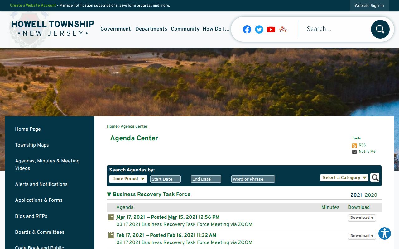
No official public Howell HOA member directory or consolidated neighborhood-association roster was found. An agenda mention can explain community context, but it does not identify residents.
Current agenda and archive material can still be useful for timing. The Township public archive includes 2025 resolution material about a letter of intent involving the Candlewood Swim/Racquet Club. That is a public property and civic reference, not evidence of a membership list. It illustrates why a development name belongs in a map or agenda search, followed by parcel and deed verification.
Howell Block Tools Compared
Official record layers and generic commercial neighbor tools serve different purposes. Public parcel, tax, and deed records identify the source, field, and date behind a result. Commercial profiles often combine property, marketing, voter, social, and address-association data. That mixture can be stale, combine same-name people, or blur the difference between an owner, a former occupant, and a household member.
| Official record layer | Generic commercial neighbor tool |
|---|---|
| Shows a defined parcel, public field, custodian, and record date. | May combine fragments with unclear source dates or relationships. |
| Tax and deed records can be checked against a block, lot, and legal description. | Address associations can persist after a move or transfer. |
| Correction or redaction starts with the public-record custodian when appropriate. | An opt-out is a separate suppression request and does not change a government record. |
The most reliable result is therefore a small, documented parcel set, followed by separate verification of each public owner record. It is more accurate than treating a compiled profile as proof.
Howell Neighbors Privacy Limits
Private block information includes household members not named in a public filing, utility customers, delivery records, unlisted numbers, juvenile names, protected voters, and DMV address data. The New Jersey Address Confidentiality Program uses a substitute address for eligible participants, while Daniel's Law can shield qualifying covered-person address information. A public parcel boundary does not show who is home or who receives mail there.
Lawful use. Use Howell neighbor records for lawful personal research, community context, or a verified property question. Do not use public information to watch, threaten, harass, intimidate, or expose another person.
New Jersey's stalking, harassment, and cyber-harassment laws can apply to repeated conduct that uses records to monitor or threaten someone. When a source displays a redaction or substitute address, do not try to reconstruct the physical address from another source.
OPRA provides access to government records with exceptions and privacy safeguards. A record custodian, not a map label or a compiled profile, is the appropriate contact for a correction or a lawful request. Respect each source's access rule, keep public findings tied to their date and custodian, and leave protected information protected.