
Howell Street Directory Walkthrough
Address research in Howell works best as a chain, not a single result. First normalize the house number, road name and suffix, then confirm that the municipality is Howell Township. Add the ZIP and block, lot, and qualifier when they are known. The county property tools are parcel-based, so a road search can return several lots, qualifiers, or tax entries. That result list is useful for reviewing a stretch of road, but it is not a census of every household. A recorded owner can be found in property and deed records; a historic directory may identify a former occupant; neither alone establishes every person who lives there now.
- Run the address through the Monmouth consolidated property search or Tax Board search. Enter Howell Township and, where the form calls for it, a street or partial street rather than assuming a full house string will work.
- Open the parcel result and retain the block, lot, qualifier, property location, owner name, year, and any prior-lot field. Compare each parcel on the chosen road instead of stopping at the first match.
- Use the county map or Howell tax-map viewer to place the parcel among nearby lots. The map helps put records in street order, but its labels are parcel information rather than household evidence.
- Search the recorded owner as a grantee in the Clerk index, then use the prior seller as an earlier grantee to follow ownership back. Save the legal description and document reference with each transfer.
- For a lawful, specific registration confirmation, use the state voter-status process. For an older household, compare the address with a reverse directory and census record instead of treating a modern record as history.
That sequence separates an address, a parcel, an ownership transfer, a limited registration record, and an older household listing. It also leaves a clear trail when a road has changed form, a lot has been divided, or an old entry uses a settlement name rather than the current address.
Howell Records by Address
Several Howell and Monmouth systems accept an address, street, parcel key, or mapped location. Their value is different. The tax record is the current assessment layer. The deed index is a transfer layer. The map shows parcel geometry, and an open-permit response describes only an open permit. Keeping those distinctions in the notes prevents a street-by-street review from overstating what one result means.
| Address record | Custodian | Street-level evidence | Access boundary |
|---|---|---|---|
| Tax and MOD-IV card | Monmouth County Tax Board | Assessed owner, parcel, class, values, year-built fields, and tax-list history where present | Address, owner, and block/lot searches; digital starting year is not stated |
| Howell tax map | Howell public tax-map viewer | Situs, owner mailing field, historical lot, zoning, map sheet, and deed link | Informational map, not a legal boundary survey |
| Property Viewer | Monmouth GIS | Parcel shape, block/lot, prior-lot context, acreage, and map layers | Map attributes have a stated January 2023 MOD-IV vintage |
| Recorded deeds | Monmouth County Clerk | Grantor, grantee, recording reference, and legal-description clues | Online coverage depends on document type and year |
| Permit or code material | Howell Community Development | Construction, inspection, or address-case leads | Open-permit response excludes closed permits; a complaint is not a finding |
The common bridge is the parcel key. A street name gathers results, while block, lot, qualifier, map sheet, and legal description help carry the same property across a subdivision or an older record. The Howell Township Maps page adds street, tax, zoning, voting, fire-district, and service-area maps when the question is geographic rather than personal.
Howell Street Directory Search Fields
The Tax Board and map tools do not use one identical form. Choose the route that fits the information already in hand. The year selector is meaningful on tax searches, but the inspected county page does not state a complete historic digital range. Results may open a MOD-IV or property card with more detail, and field availability can vary by parcel and year.
| Howell tool | Fields to enter | Result or control |
|---|---|---|
| Tax Board address | Street name, township, year | Search, then property/MOD-IV result |
| Tax Board owner | Owner name, township, year, tax-exempt control | Owner and property results |
| Tax Board block/lot | Block, lot, qualifier, exemption choice, township, year | Parcel result |
| Consolidated property | Township plus street or partial street; alternatively owner or block/lot | Search Results and Map & Property Info |
| Howell tax map | Municipality, block, lot, historical block/lot, street, house number, or map sheet | Parcel Info, index maps, key street map, or map book |
A view of the Howell tax-map viewer shows the local controls for block, lot, historical identifiers, street, and house number.
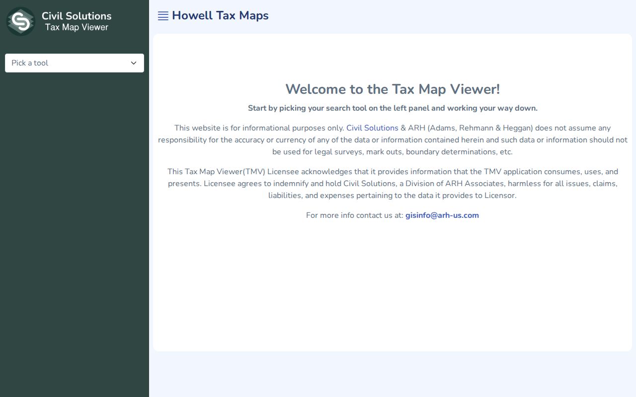
Use the historical block and lot fields when a current road label does not reach an older deed or map reference. The viewer separates the parcel from the address used for owner correspondence, which is a key check before recording a result as a location.
Note: Save the search year and the exact field combination because an address-only result may look different after a parcel or tax-list update.
Howell Address Mailing Data
The Howell tax-map viewer makes an important distinction visible: the owner street address, city, state, and ZIP are separate from the property location. The first is a correspondence field. The second is the physical parcel, often called the situs. A property can have a postal label that differs from its legal municipality, and an out-of-town mailing field is not proof that the owner is absent or that another person is present. Record both fields exactly, then let a deed or directory supply its own dated evidence.
- Parcel
- A tract carried in tax and map records, usually identified by municipality, block, lot, and sometimes a qualifier.
- Situs address
- The physical location assigned to the parcel. It is not the same thing as the owner mailing address.
- Plat
- A recorded subdivision or map document that can show how a tract became individual lots. Its map reference can outlast a street-label change.
- Criss-cross directory
- A reverse directory arranged from address or street to a listed historical occupant or business, rather than only from name to address.
Prior lot, historical lot, map-sheet number, and legal description are especially helpful when a parcel is split or renumbered. A simple address should start the search, but the parcel identifiers are the safer way to test whether two records concern the same Howell property.
Map Howell Streets With GIS
The Monmouth County Property Viewer is the map bridge for a named road. It supports shape selection, block-and-lot searches, map clicks, and buffer tools. Select a parcel, note its legal identifiers, then move along the road through adjacent shapes or a narrow drawn area. The property information can include municipal code, PAMS_PIN, class, acreage, year built, prior block/lot, and geometry. Map layers may also supply zoning, roads, districts, flood, or other context.
The ArcGIS item was updated in 2026, but its stated MOD-IV parcel attributes run through January 2023. Treat the map as an orientation and adjacency tool, then verify a current owner, tax value, or transfer with the Tax Board or Clerk. The Monmouth GeoHub provides related mapping and open-data resources when a layer is needed beyond the parcel viewer.
For a road with many lots, work in short segments and save only the public parcel identifiers. A buffer can include parcels that face a side street or touch a corner, so the selected geometry should be checked against the street label before drawing any conclusion about frontage.
Howell Street Directory Deed Trail
The Monmouth County Clerk deed index connects the parcel to recorded transfers. Search a current owner as grantee in a likely date range, inspect the resulting instrument, and log the seller, document type, recording date, instrument or book-and-page reference, municipality, and legal description. Search that seller as an earlier grantee, then repeat. Name variants, trustees, estates, and business entities may require separate searches. A deed creates an ownership trail, not an automatic list of everyone at the address.
The Clerk interface provides instrument, book, page, document type, municipality, date, parcel, and name modes. It uses a percent sign for name wildcards and can show an image for a returned record. The online system is informational, not a title opinion. The Clerk directs title work to an in-person search or a qualified title professional, and certified-copy requests remain with the Clerk.
A view of the Clerk deed-index search shows the instrument, name, document-type, and parcel paths available for a Howell address trail.
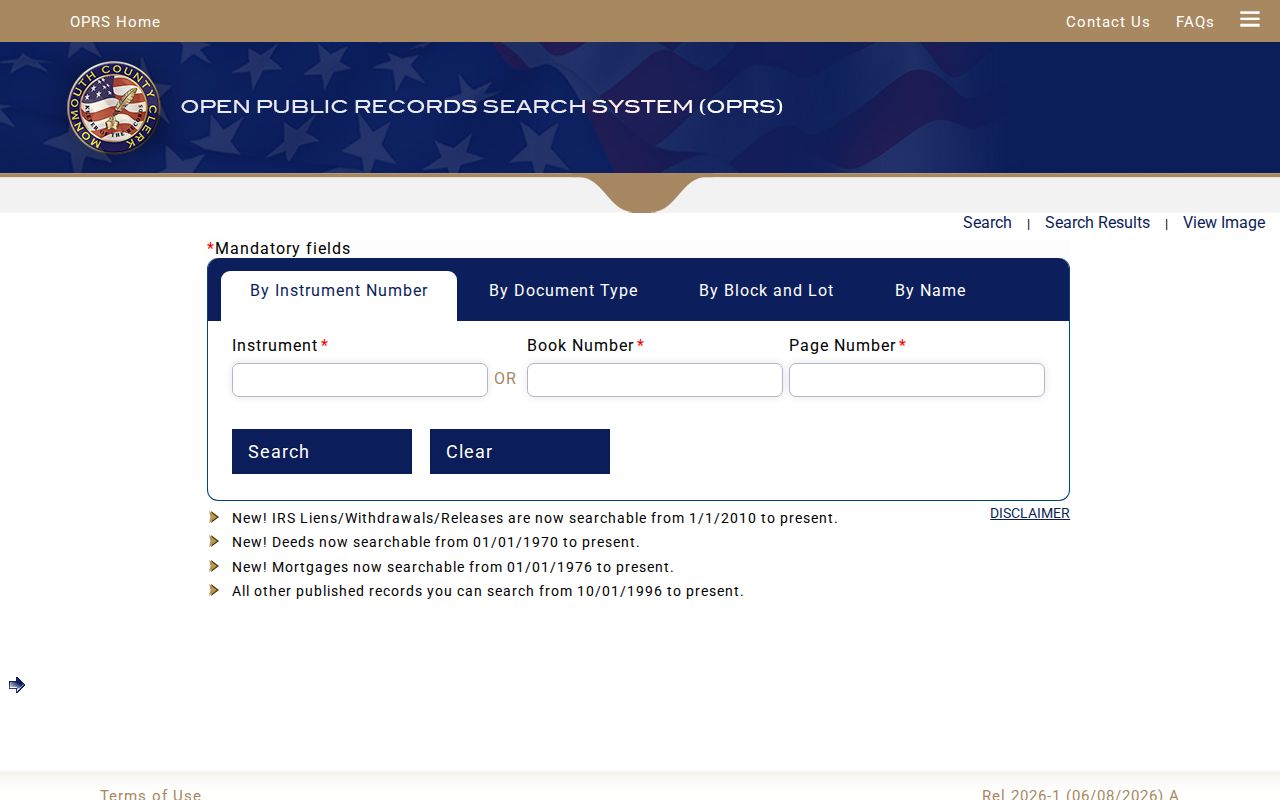
Deeds are searchable online from 1970, while mortgages begin in 1976, IRS liens and releases in 2010, and other published instruments in 1996. Earlier deeds require the County Clerk books or indexes in Freehold, an Archives inquiry, or historical collections. The document type controls the cutoff.
Howell Street Permits and Voters
Address-linked municipal material can help date changes along a road, but it has narrow limits. Howell’s SDL property layer may show current or historical permits, inspections, and property data, while the municipal open-permit request asks for the property owner and address and returns either a list of open permits or “No Open Permits.” Closed permits are expressly excluded. For an older project, ask Construction Code or Community Development for the correct record path rather than treating an empty open-permit reply as a complete history.
New Jersey’s public voter-status check is a limited, person-specific confirmation. It does not offer a public control to list every voter on a Howell street. A county voter list is a separate controlled request under N.J.S.A. 19:31-39, with signatures and protected addresses excluded. The state tool can confirm a legitimate match, but it cannot establish a complete street roster or reveal ballot choices.
Note: Permit, voter, and complaint records should be read for their stated purpose, never as proof of a person’s conduct or present presence.
Historic Howell Street Names
Old Howell addresses often use more than a different house number. Jerseyville was previously Green Grove and received its later name in 1854. Historic records can also use Adelphia, Southard, Bethel, Ramtown, Squankum, Freewood Acres, or Ardena, along with a rural route or crossroads. Try the present road, the historic settlement name, and the legal description in separate searches. A reverse entry is most useful once the address has been normalized but should not be forced to match a modern label.
The county directory runs are the historical shelf for this work, including material from 1875, the “Monmouth County and its Cities” microfilm sequence for 1883 through 1970, and selected later nineteenth- and twentieth-century runs. The collections, reels, and how to read their entries are covered on the Howell City Directories page. Here, their use is narrow: test an address, route, or settlement term against a dated household entry after the parcel path has been documented.
The Township’s local history is a reliable starting point for the alternate settlement labels. Preserve the spelling found in the original document, even when a current map uses another name.
Howell Street Boundaries
Postal routing, map geography, and legal municipal boundaries do not always align. Howell parcels can use Howell, Farmingdale, Freehold, or Adelphia postal labels. The current street map and parcel record should decide the municipal identity, not the city printed in a correspondence field. This matters when comparing roads near the township edge or looking for a transfer under a prior jurisdiction.
One specific historic boundary clue involves about 58 acres that shifted from Wall Township to Howell around 2003 near Pine View and Ramtown. A deed, plat, or older directory can therefore point to Wall even when a current parcel falls in Howell. Search both municipality names when the legal description or date suggests that boundary area, and use the deed’s lot language rather than assuming the present street label resolves the issue.
Howell Street Directory Limits
Public street records do not reveal a complete household. Tax and deed results generally identify an assessed or recorded owner. The voter-status tool is limited. A historic directory is dated and may use a route or post-office name. Open-permit responses omit closed permits. Utility customer lists, DMV addresses, private delivery information, protected voter details, and many household relationships are not public street-directory fields. A map boundary does not say who is home, who receives mail there, or who has a private agreement connected to the parcel.
Lawful personal use. Howell address records can support family history, property research, civic questions, and personal safety checks. Do not use a record trail to stalk, harass, intimidate, or harm any person, and honor redactions and safety-protected addresses.
When a needed record is not online, choose the custodian that holds it. The County Clerk and Archives handle different historical materials, and the Howell Municipal Clerk is the local OPRA route for a specific municipal record. A narrow request that identifies the address, record type, and date range is more likely to reach the right records system than a request for a new street-wide list.